
How ISRO used satellite remote-sensing to analyse glacial lakes in Himalayas
- Earlier this week, the Indian Space Research Organisation (ISRO) released satellite-data-based analysis on expansion of glacial lakes in the catchments of Indian Himalayan river basins.
- This is the latest among a clutch of studies on glacial lakes that have highlighted the risks and impact of glacial lake outburst floods (GLOFs),
What did ISRO’s analysis reveal?
- ISRO’s analysis looked at satellite data archives spanning the past four decades to assess changes in the glaciated environment.
- Long-term satellite imagery covering the catchments of Indian Himalayan river basins - spread over India, Nepal, Tibet, and Bhutan - is available from 1984 onwards, till 2023.
- ISRO’s data has indicated significant expansion in the size of glacial lakes.
- ISRO said that 130 of the 676 lakes are situated in India, in the Indus (65), Ganga (7), and Brahmaputra (58) river basins.
- These lakes have expanded as glaciers are retreating at an ever faster rate due to global warming.
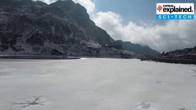
How are glacial lakes formed?
- The movement of glaciers causes erosion and creates depressions in the surrounding topography.
- When they retreat, meltwater starts to accumulate in such depressions, giving birth to glacier lakes.
- ISRO categorised glacial lakes into four broad categories based on how they were formed - moraine-dammed, ice-dammed, erosion-based, and ‘others’.
- Erosion-based lakes are formed when water is dammed by erosion-created depressions.
- “GLOFs occur when glacial lakes release large volumes of meltwater due to the failure of natural dam, resulting in sudden and severe flooding downstream.
How is satellite remote-sensing technology used to monitor glacial lakes?
- The monitoring of glacial lakes and their expansion in the Himalayan region is challenging due to the rugged terrain.
- This is where, according to ISRO, satellite remote-sensing technology “proves to be an excellent tool for… monitoring due its wide coverage and revisit capability”.
How can the risks posed by glacial lakes be mitigated?
- In 2023, a study published in the Journal of Geophysical Research examined the risks posed by Ghepan Gath lake - located at an elevation of 4,068 m in Himachal Pradesh - to Sissu in Lahaul valley, and modelled the impacts of lowering the water levels in the lake.
- It found that lowering of the lake levels by 10 to 30 m significantly reduces the impacts on Sissu town, though not completely eliminating the risks posed by a GLOM event.